

- 94.0LEGITIMACY SCORE
- 97.0SAFETY SCORE
- 4+CONTENT RATING
- $3.99PRICE
What is NZ Topo50 North Island? Description of NZ Topo50 North Island 2334 chars
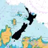
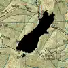
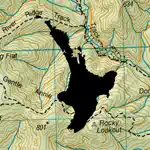
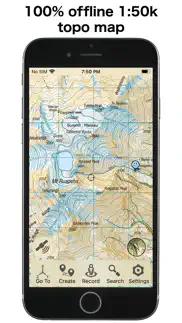
This app provides complete offline topographic map coverage of the North Island of New Zealand from the LINZ Topo50 1:50k scale map series. The maps are all contained in the installation so there is no additional need for downloads, no need for phone or wifi signal, no slow server issues, no account signups, no missing tiles, and no additional map fees. Just install for seamless off-line zooming and panning across the whole island down to 1:50k scale. The app also includes 1:50k resolution satellite images for the island, and elevation data.
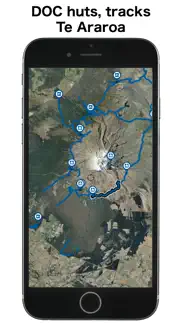
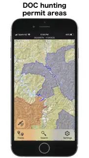
Other integrated data includes DOC hunting permit boundaries, DOC huts, campgrounds, and tracks, Fish and Game access points, Te Araroa trails, Public Conservation Land boundaries, selected public road parcels. Other datasets can be imported.
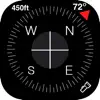
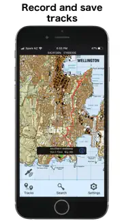
The app has a full suite of navigation functions including GPS location, compass orientation, distance to map locations, track recording and graphing, route creation and following, import/export of gpx and kml files, search functions for named places and user data. Add and edit your own locations and routes and plot elevation profiles. Use your camera view to identify surrounding peaks and match with local topography. Uses an intuitive simple interface with one-touch access to all functions.
LINZ TOPO250 series maps are used at lower zoom levels for easier navigation.
Perfect for outback use out of cell phone range. GPS and maps function fully without phone coverage. No need to cache files in advance either as they are all fully installed with the app. Popular with trampers, hikers, runners, bikers, search and rescue (SAR), hunters, boaters, flying, paragliding, as well as survey applications.
Note that continuous use of GPS will run down the battery faster than when not using the GPS. The NZTopo50 app gives you full control over when GPS is used. The map can be used without GPS, intermittently with GPS for spot checking of location, continuously for logging while the app is open, or for continuous background logging when the phone is off.
Check our website for links to user guides and useful tips and tricks.
The in-app purchase is an optional contribution to ongoing app development. It doesn't affect the functionality of the app or the availability of updates.
Feel free to get in touch with any suggestions.
- NZ Topo50 North Island App User Reviews
- NZ Topo50 North Island Pros
- NZ Topo50 North Island Cons
- Is NZ Topo50 North Island legit?
- Should I download NZ Topo50 North Island?
- NZ Topo50 North Island Screenshots
- Product details of NZ Topo50 North Island
NZ Topo50 North Island App User Reviews
What do you think about NZ Topo50 North Island app? Ask the appsupports.co community a question about NZ Topo50 North Island!
Please wait! Facebook NZ Topo50 North Island app comments loading...
NZ Topo50 North Island Pros
✓ AAwesome app just wonder how do I get the Pointer to show which direction I am facing. Thanks.Version: 5.2
✓ Tuhoe land or DOC landTuhoe land now covered as DOC land?.Version: 4.4
✓ NZ Topo50 North Island Positive ReviewsNZ Topo50 North Island Cons
✗ Good mapIs it possible to set a go to with a distance to go bearing ect ? Thanks.Version: 5.6
✗ Pretty averageEnd up just taking photos of actual maps.Version: 4.81
✗ NZ Topo50 North Island Negative ReviewsIs NZ Topo50 North Island legit?
✅ Yes. NZ Topo50 North Island is 100% legit to us. This conclusion was arrived at by running over 61 NZ Topo50 North Island user reviews through our NLP machine learning process to determine if users believe the app is legitimate or not. Based on this, AppSupports Legitimacy Score for NZ Topo50 North Island is 94.0/100.
Is NZ Topo50 North Island safe?
✅ Yes. NZ Topo50 North Island is quiet safe to use. This is based on our NLP analysis of over 61 user reviews sourced from the IOS appstore and the appstore cumulative rating of 5/5. AppSupports Safety Score for NZ Topo50 North Island is 97.0/100.
Should I download NZ Topo50 North Island?
✅ There have been no security reports that makes NZ Topo50 North Island a dangerous app to use on your smartphone right now.
NZ Topo50 North Island Screenshots
Product details of NZ Topo50 North Island
- App Name:
- NZ Topo50 North Island
- App Version:
- 5.80.05
- Developer:
- Right Place Resources
- Legitimacy Score:
- 94.0/100
- Safety Score:
- 97.0/100
- Content Rating:
- 4+ Contains no objectionable material!
- Category:
- Navigation, Sports
- Language:
- EN
- App Size:
- 1.93 GB
- Price:
- $3.99
- Bundle Id:
- sqrl.net.NZTopo50.NI
- Relase Date:
- 20 February 2013, Wednesday
- Last Update:
- 30 January 2024, Tuesday - 03:59
- Compatibility:
- IOS 16.0 or later
Updated maps and data Support for custom map images New scrolling interface - more info where you need it Duplicate tracks easily Map alignment with course option Dedicated fullscreen button Other improvements.