

- 62.0LEGITIMACY SCORE
- 63.5SAFETY SCORE
- 4+CONTENT RATING
- $14.99PRICE
What is Flytomap All in One HD Charts? Description of Flytomap All in One HD Charts 3733 chars
FlyToMap™ is a valid and interesting alternative, Benetti Yachts
► The charts downloaded are resident in the app. No internet connection required!
Flytomap All In One HD works on all Apple devices
FlyToMap™ offers a revolutionary app; you can download any chart worldwide (500+) free of charge
Check out your area on viewer.flytomap.com
- All USA Marine charts (US All, East, West, Great Lakes, Major Rivers, Florida, Texas, California, etc.)
- USA Lake Maps 15000+ : Minnesota, Maine, Michigan, Massachusetts, Wisconsin, Texas, California, Florida, Iowa, North and South Dakota...and many more.
- 150+ USA Parks and Forests
- Australia Marine Charts
- Australia Parks
- New Zealand Marine charts
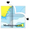
- All Europe Marine Charts
- 200+ major EU Parks
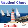
- The world's most famous holiday destinations ie: Caribbean, Seychelles, Mauritius, Maldives, Canary Islands, Azores, Bora Bora, Bali, Oslo Fjord .. and many more.
- Canada Lake Maps: Alberta, Lake of the Wood.. and many more.
► Worldwide Marine and Outdoor Maps available, thanks to viewer.flytomap.com
► Worldwide Satellite images overlay on charts
► Worldwide Terrain features overlay on charts, thanks to Open Street Map, Open Cycle Map, Bing, Earth, GMap
► Interactive Weather forecast
► NOAA raster charts seamless with continuous updates from the official Government server
► ActiveCaptain - Worldwide boaters community, with 200.000 + Captains
Use to Explore:
√ Latitudes and Longitudes to go to your favorite places
√ Search your Favorite points directly
√ Zoom, Rotate and Pan fast just by a finger touch
√ Quick Object information just tapping, thanks to vector technology
√ GPS Heading Vector Towards the direction movement
√ Distance Measurement Tool to easily calculate the distance from one location to another
√ Route planning, unlimited Waypoints - Insert the target/destination and see in real time your speed, distance and bearing
√ Magnified Lens for all info
√ Unlimited Tracks, Markers, Geo-tagged photos, records and share via email, visible on Google, Flytomap Viewer, KMZ format - Store your track without the need of cellular data or mobile signal
√ Select Depth Contours
√ a la carte menu
√ iOS background mode - Flytomap works in background as well, you can swap with another app and receive/make calls send sms while track recording.
√ Optimized battery usage
√ And so much more to come - It’s the only app you will ever need! Our charts are installed on: NAVICO LOWRANCE B&G NORTHSTAR EAGLE SIMRAD
Follow us:
▶ Twitter @flytomap
▶ Web Site flytomap.com
▶ Facebook facebook.com/flytomap
FlytoMap™ has a wide range of Applications and Maps for you to use - Free of charge on Flytomap All In One !
- WATER MAPS
Electronic Nautical Charts with the same accuracy and detail as on your chart plotter. Maps include Coastline, Anchoring areas, Fishing areas, Restriction areas, Obstructions, Rocks, Buoys, Beacons, Lights, Depth contours, Spot Soundings and more.
- LAKE MAPS
High quality lake maps with detailed information: Depth Contours, Boat Ramps, Fishing spots etc. Maps also include Trails, Roads and Railways information.
- PARK MAPS:
Extremely advanced electronic charts with information collected from National/State Park and Forest Services and many other local sources. The maps contain trails (Hiking, Biking, Equestrian trails etc.,) and Points of interest (POI) like Campgrounds, Visitor Centers, Lookout points, Eating places, Ranger Stations, Picnic areas, Boat/Canoe ramps, Parking areas etc..
- TRAVEL MAPS
These Maps cover the most interesting touristic areas combining Sea and Land information to allow you a complete travel experience.
- Flytomap All in One HD Charts App User Reviews
- Flytomap All in One HD Charts Pros
- Flytomap All in One HD Charts Cons
- Is Flytomap All in One HD Charts legit?
- Should I download Flytomap All in One HD Charts?
- Flytomap All in One HD Charts Screenshots
- Product details of Flytomap All in One HD Charts
Flytomap All in One HD Charts App User Reviews
What do you think about Flytomap All in One HD Charts app? Ask the appsupports.co community a question about Flytomap All in One HD Charts!
Please wait! Facebook Flytomap All in One HD Charts app comments loading...
Flytomap All in One HD Charts Pros
✓ Best MapGreat Map, have used some for a while now. downloaded this map refered by a friend, and it's indeed a great product. Finally track saving and GPS features are outstanding with the update..Version: 2.5.3
✓ It really helpsI think anyone who wants to get a good marine Gps should invest in this app. The map works wonderfully and I had no problem figuring out how to use it and find what I need..Version: 2.5
✓ Flytomap All in One HD Charts Positive ReviewsFlytomap All in One HD Charts Cons
✗ JUNK DOESNT EVEN OPENApp is junk doesnt even open stays on some msg screen then shuts off waste of $20 as u cant even use it also the marine map for perth does the exact same thing with the same useless mag screen VERY DISSAPOINTED!!!!!!!!.Version: 3.5.1
✗ Crash courseGreat concept very poor execution. Crashes constantly. Do NOT buy until this is corrected. Tried contacting developer with zero response . They just take your money and run and you can't track them on this app BECAUSE IT CRASHES!!!!!! Have contacted developer 2x with no response . I guess they are using this app to find their office...never to be heard from again. Dr. Livingston , table for one..Version: 0
✗ Flytomap All in One HD Charts Negative ReviewsIs Flytomap All in One HD Charts legit?
✅ Yes. Flytomap All in One HD Charts is legit, but not 100% legit to us. This conclusion was arrived at by running over 42 Flytomap All in One HD Charts user reviews through our NLP machine learning process to determine if users believe the app is legitimate or not. Based on this, AppSupports Legitimacy Score for Flytomap All in One HD Charts is 62.0/100.
Is Flytomap All in One HD Charts safe?
✅ Yes. Flytomap All in One HD Charts is quiet safe to use. This is based on our NLP analysis of over 42 user reviews sourced from the IOS appstore and the appstore cumulative rating of 3.2/5. AppSupports Safety Score for Flytomap All in One HD Charts is 63.5/100.
Should I download Flytomap All in One HD Charts?
✅ There have been no security reports that makes Flytomap All in One HD Charts a dangerous app to use on your smartphone right now.
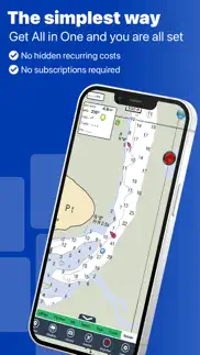
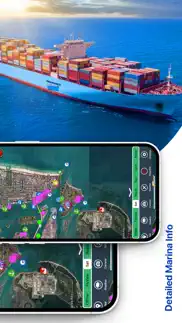
Flytomap All in One HD Charts Screenshots


Product details of Flytomap All in One HD Charts
- App Name:
- Flytomap All in One HD Charts
- App Version:
- 6.5.8
- Developer:
- Flytomap
- Legitimacy Score:
- 62.0/100
- Safety Score:
- 63.5/100
- Content Rating:
- 4+ Contains no objectionable material!
- Category:
- Navigation, Travel
- Language:
- EN FR DE IT PT ES
- App Size:
- 127.30 MB
- Price:
- $14.99
- Bundle Id:
- com.flytomap.FlyToMapHD
- Relase Date:
- 08 July 2010, Thursday
- Last Update:
- 17 February 2023, Friday - 18:08
- Compatibility:
- IOS 12.0 or later
Charts added: Albemarle Sound Apalachee Bay Bar Harbour Baton Rouge Black Bay Houma Cape Elizabeth to Cape Ann Central California Columbia River Fiji Florida South West Georges Bank Houston Juan de Fuca Strait Laguna Madre Lake Superior West Long Isl....