
- 99.0LEGITIMACY SCORE
- 99.5SAFETY SCORE
- 4+CONTENT RATING
- $1.99PRICE
What is GBTopoMap? Description of GBTopoMap 2691 chars
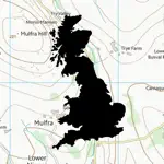
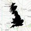
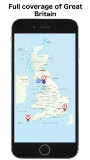
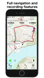
This app gives 100% offline topographic map coverage of Great Britain installed directly with the app. No further downloads required, no account signups, no ongoing subscriptions, just seamless pan and zoom across the whole country at an effective resolution of about 1:25k. Perfect for outdoor use, walking, running, hunting, fishing, cycling, particularly in remote areas with poor cellphone coverage.
Please note that this is a large app (4GB) and you will need to have sufficient space to install it.
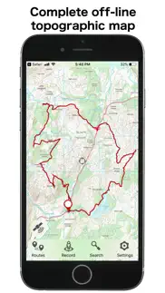
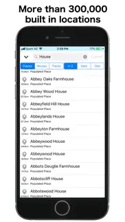
GBTopoMap includes full navigation functions including route planning, track recording, navigation to points or following routes, over 300,000 built in locations and landmarks. Directly import or share files from any source or channel of your choice. Maps are based on Ordnance Surveys VectorMap District and terrain data that gives 10 m contour intervals, combined with OpenStreetMap data on public access ways. The maps are fully installed on your device when you download and install the app from the App Store. Maps will update periodically after that using standard app version updates through the App Store.
Works well with popular British sites describing local walks and activities. Click on .gpx or .kml track links to import directly into the app.
The app is build from the ground up to use the true British National Grid, not the commonly used WGS84 global approximation which doesn't give a true uniform grid. We also design from the ground up for functionality. Controls are at the bottom of the screen where you can operate them one handed without shifting your grip, and information is biased towards the top of the screen. All functionality can be accessed with a single tap from the main screen, so that there are no nested layers of menus that you have to navigate or memorise to find what you are after.
The app is completely stand-alone and doesn't require account logins or requests for contact information, feedback, or ratings. We are delighted to hear from anyone with a question or suggestion, and you can check out some of our online info and guides, but you won't hear from us otherwise.
Please note that, as with any GPS navigational app, use of GPS positioning will place a higher demand on your battery and continuous use of GPS will discharge the battery at a faster rate. The GBTopoMap app gives you full control over this. GPS positioning is only activated when actually needed and can be switched on or off at the tap of a button.
Tip of the day: For navigating using the compass functions, look up how to do the 'figure of 8' wave to trigger internal calibration of the compass. Easy to do and makes for reliable and accurate compass readings.
- GBTopoMap App User Reviews
- GBTopoMap Pros
- GBTopoMap Cons
- Is GBTopoMap legit?
- Should I download GBTopoMap?
- GBTopoMap Screenshots
- Product details of GBTopoMap
GBTopoMap App User Reviews
What do you think about GBTopoMap app? Ask the appsupports.co community a question about GBTopoMap!
Please wait! Facebook GBTopoMap app comments loading...
Is GBTopoMap legit?
✅ Yes. GBTopoMap is 100% legit to us. This conclusion was arrived at by running over 16 GBTopoMap user reviews through our NLP machine learning process to determine if users believe the app is legitimate or not. Based on this, AppSupports Legitimacy Score for GBTopoMap is 99.0/100.
Is GBTopoMap safe?
✅ Yes. GBTopoMap is quiet safe to use. This is based on our NLP analysis of over 16 user reviews sourced from the IOS appstore and the appstore cumulative rating of 5/5. AppSupports Safety Score for GBTopoMap is 99.5/100.
Should I download GBTopoMap?
✅ There have been no security reports that makes GBTopoMap a dangerous app to use on your smartphone right now.
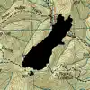
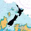
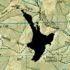
GBTopoMap Screenshots
Product details of GBTopoMap
- App Name:
- GBTopoMap
- App Version:
- 1.1
- Developer:
- Right Place Resources
- Legitimacy Score:
- 99.0/100
- Safety Score:
- 99.5/100
- Content Rating:
- 4+ Contains no objectionable material!
- Category:
- Navigation, Health & Fitness
- Language:
- EN
- App Size:
- 3.98 GB
- Price:
- $1.99
- Bundle Id:
- net.sqrl.GBTopoMap
- Relase Date:
- 17 May 2019, Friday
- Last Update:
- 01 December 2019, Sunday - 05:24
- Compatibility:
- IOS 13.0 or later
Tracks, paths, and public access ways from the OpenStreetMap database added. Support for iOS 13 light and dark mode..