


- 74.4LEGITIMACY SCORE
- 74.9SAFETY SCORE
- 4+CONTENT RATING
- $5.99PRICE
What is NOAA Nautical Charts & Map? Description of NOAA Nautical Charts & Map 2284 chars
The premium and best app for Nautical Navigation Charts and Maps:
* 1000+ NOAA Raster Navigational Charts (RNC) available for download and for offline use. RNC are high resolution, full-color, geo-referenced, digital images of NOAA paper nautical charts.
* 1000+ NOAA Navigational Charts for online use that includes GPS location, navigation plotting and more.
* Basic instrumentation - GPS location, Longitude, Latitude and Device Compass.
* Assitance Support - Link to Navigation Center, Radio Information.for Boaters.
Additional information about the charts and data provided with this app:
NOAA RNC® charts are full-color, geo-referenced, digital images of NOAA paper nautical charts.
RNCs can be used with global positioning system (GPS) enabled electronic chart systems or other “chart plotter” display systems to provide real-time vessel positioning.
NOAA RNCs comply with the International Hydrographic Organization RNC Product Specification.
RNCs are approved for use by IMO ECDIS mandated vessels only if adequate ENC data is not available. Since complete ENC coverage is available in all U.S. waters, vessels required to use ECDIS may not navigate with NOAA RNCs.
NOAA RNCs DO NOT meet USCG chart carriage requirements for commercial vessels.
NOAA RNCs may be downloaded free from the NOAA chart locator or the NOAA nautical chart catalog.
----------
Electronic Navigational Charts (ENC) are vector data sets that support all types of marine navigation. Originally designed for large commercial vessels using a sophisticated navigational computer called an Electronic Chart Display and Information System (ECDIS), ENCs are now also being used on simpler electronic chart systems and “chart plotters” on many types of ships and by recreational boaters. NOAA ENCs help provide real-time ship positioning, as well as collision and grounding avoidance.
NOAA ENCs comply with the International Hydrographic Organization ENC Product Specification. ENCs are produced around the world by many different countries’ national hydrographic or charting agencies. NOAA maintains more than 1,000 NOAA ENC® datasets over U.S. coastal waters and the Great Lakes. The U.S. Army Corps of Engineers produces a similar product, called Inland ENC (IENC) for many U.S. rivers.
- NOAA Nautical Charts & Map App User Reviews
- NOAA Nautical Charts & Map Pros
- NOAA Nautical Charts & Map Cons
- Is NOAA Nautical Charts & Map legit?
- Should I download NOAA Nautical Charts & Map?
- NOAA Nautical Charts & Map Screenshots
- Product details of NOAA Nautical Charts & Map
NOAA Nautical Charts & Map App User Reviews
What do you think about NOAA Nautical Charts & Map app? Ask the appsupports.co community a question about NOAA Nautical Charts & Map!
Please wait! Facebook NOAA Nautical Charts & Map app comments loading...
NOAA Nautical Charts & Map Pros
✓ GoodIt a good app I love it.Version: 1.2
✓ Great for sailingThe hi-resolution chart are helpful.Version: 1.2
✓ NOAA Nautical Charts & Map Positive ReviewsNOAA Nautical Charts & Map Cons
✗ Don’t do itDid not have they charts needed. Orientation of charts they did have was so poor it was useless. Made you pay prior to seeing how crappy the ap was..Version: 1.2
✗ NOAA Nautical Charts & Map Negative ReviewsIs NOAA Nautical Charts & Map legit?
✅ Yes. NOAA Nautical Charts & Map is legit, but not 100% legit to us. This conclusion was arrived at by running over 28 NOAA Nautical Charts & Map user reviews through our NLP machine learning process to determine if users believe the app is legitimate or not. Based on this, AppSupports Legitimacy Score for NOAA Nautical Charts & Map is 74.4/100.
Is NOAA Nautical Charts & Map safe?
✅ Yes. NOAA Nautical Charts & Map is quiet safe to use. This is based on our NLP analysis of over 28 user reviews sourced from the IOS appstore and the appstore cumulative rating of 3.7/5. AppSupports Safety Score for NOAA Nautical Charts & Map is 74.9/100.
Should I download NOAA Nautical Charts & Map?
✅ There have been no security reports that makes NOAA Nautical Charts & Map a dangerous app to use on your smartphone right now.
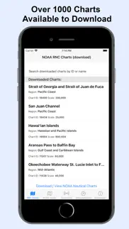
NOAA Nautical Charts & Map Screenshots


Product details of NOAA Nautical Charts & Map
- App Name:
- NOAA Nautical Charts & Map
- App Version:
- 1.2
- Developer:
- Amni LLC
- Legitimacy Score:
- 74.4/100
- Safety Score:
- 74.9/100
- Content Rating:
- 4+ Contains no objectionable material!
- Category:
- Navigation, Lifestyle
- Language:
- EN
- App Size:
- 894.00 KB
- Price:
- $5.99
- Bundle Id:
- a.NauticalNavigation.Charts
- Relase Date:
- 16 November 2020, Monday
- Last Update:
- 19 November 2020, Thursday - 18:17
- Compatibility:
- IOS 13.0 or later
RNC Viewer integration for online Charts.