

- 19.0LEGITIMACY SCORE
- 19.5SAFETY SCORE
- 4+CONTENT RATING
- FreePRICE
What is Topo Maps+? Description of Topo Maps+ 3007 chars
Designed and tested on real dirt by outdoor enthusiasts, Topo Maps+ is packed with good planning tools, trustworthy maps, on-trail tools, and tips to enhance YOUR navigational mindset. Topo Maps+ for Mac has the complete feature set to plan your trip and keep you safe in the backcountry.
Take advantage of the larger screen for planning your backpacking trips then sync your trip details over to your iOS device and head out into the backcountry!
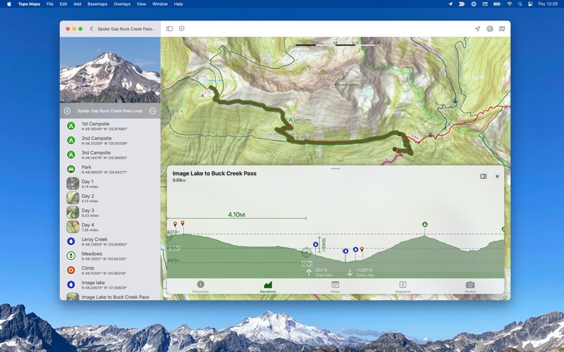
‣‣ PLANNING TOOLS
‣ Compare maps
‣ Combine overlays to customize your map view
‣ Smart route-building tools
‣ Unlimited waypoints
‣ Print, email or share custom maps and routes
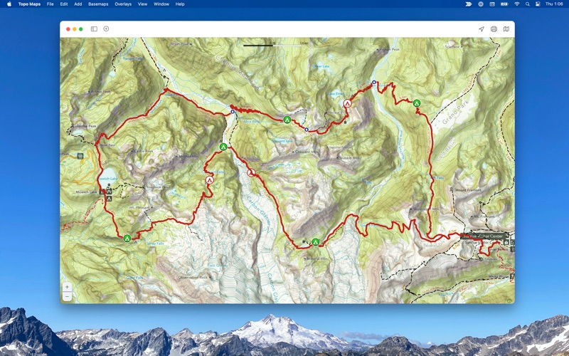
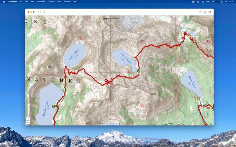
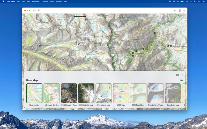
‣‣ TRUSTWORTHY MAPS
From the Gold Standard of traditional USGS, the backcountry features of the US Forest Service, Satellite Imagery, Land Use, Land Cover, the incredible Natural Atlas, NOAA Marine Maps, Canada’s NRCAN/GEOBC, New Zealand Topo Maps from LINZ.
To amazing worldwide maps from ESRI’s ArcGIS including Topo, Street, and Satellite!
Enhance your maps with custom overlays like:
‣ Worldwide Elevation Heat map - custom color the map based on elevations
‣ US Slope Map - custom shade the map with colors based on slope degrees
‣ Hill Shading
With the iOS companion app you can also have:
‣‣ ON-TRAIL TOOLS (Offline)
‣ View your current location
‣ Record your tracks
‣ Proximity Alerts (notify me when I’m close to a waypoint, trail, or region)
‣ Line of Sight
‣ Progress on Trail
‣ Guide Me to a waypoint
‣ Downloaded elevation data for route-creation on the trail
‣ Photo Waypoints (snap a pic and instantly shows on the map)
‣‣ NAVIGATIONAL MINDSET - helpful tips and tricks for keeping you safe in the backcountry!
For high resolution maps there are both subscription access to premium maps & features as well as the ability to purchase individual maps from National Geographic, Benchmark, and Canada’s Backroad Mapbooks. Purchases (subscription and individual maps) can be used across all your Apple devices. No hidden or extra fees.
CLOUD
Sync your routes, trips, subscriptions, and waypoints between all of your iOS devices.
SUBSCRIPTION LEVELS
Free: Sync Data, Elevation Profiles, Waypoints, Export Data, Import Data, Share Data
Annual or Quarterly Pro Subscription: Access to high resolutions maps, premium maps, and advanced features.
SUBSCRIPTION PAYMENT INFORMATION
Topo Maps+ subscriptions will be charged to your Apple ID account at the confirmation of purchase. Subscription automatically renews unless it is canceled at least 24 hours before the end of the current period. Your account will be charged for renewal within 24 hours prior to the end of the current period. Any unused portion of a free trial period, if offered, will be forfeited when the you purchase a subscription. You can manage and cancel your subscriptions by going to your account settings on the App Store after purchase.
Privacy Policy: https://glacierpeak.app/privacy
Terms of Service: https://glacierpeak.app/tos
- Topo Maps+ App User Reviews
- Topo Maps+ Pros
- Topo Maps+ Cons
- Is Topo Maps+ legit?
- Should I download Topo Maps+?
- Topo Maps+ Screenshots
- Product details of Topo Maps+
Topo Maps+ App User Reviews
What do you think about Topo Maps+ app? Ask the appsupports.co community a question about Topo Maps+!
Please wait! Facebook Topo Maps+ app comments loading...
Topo Maps+ Pros
✓ Mike MillerI use this for work. Seems to work fine. Would like to hae a township, range , and section layer. Maybe it does and i cant find it.Version: 7.2.3
✓ 5 Stars This is the best Hiking AppThis is the best hiking app. Easy to use, great tech support, uses very little battery energy. Easy to plan a route or just to check where your at. Very accurate for trails, it uses the path that others have hiked on when there are multiple paths/trails or old trails on maps. I have used this for 2 years in Yellowstone and Grand Teton National Parks..Version: 1.1
✓ Topo Maps+ Positive ReviewsTopo Maps+ Cons
✗ Good iPhone app, crap Mac app.I love using this on my iPhone. But, for the last year or so, the Mac version has been terrible. I've reinstalled it so many times and it keeps crashing any time I try to do anything with it. Yes, I have everything up to date. Please fix this..Version: 1.5
✗ UninstalledWhy do I have to create an account with you to use your app?? I have no intent to make any purchases or so. Account creation should be OPTIONAL. I have way too many other accounts I have to maintain (for the right reason). BTW: you can't even close this app unless you creat an account (total nonsense). You have to force-quit it. I've uninstalled your app. I'd be happy to purchase it from App Store if you change your mind about accounts and tracking, otherwise: bye!.Version: 6.6
✗ Topo Maps+ Negative ReviewsIs Topo Maps+ legit?
Topo Maps+ scam ~ legit report is not ready. Please check back later.
Is Topo Maps+ safe?
Topo Maps+ safe report is not ready. Please check back later.
Should I download Topo Maps+?
Topo Maps+ download report is not ready. Please check back later.
Topo Maps+ Screenshots
Product details of Topo Maps+
- App Name:
- Topo Maps+
- App Version:
- 7.6.1
- Developer:
- Glacier Peak Studios LLC
- Legitimacy Score:
- 19.0/100
- Safety Score:
- 19.5/100
- Content Rating:
- 4+ Contains no objectionable material!
- Language:
- EN FR DE IT JA RU ZH
- App Size:
- 118.95 MB
- Price:
- Free
- Bundle Id:
- app.glacierpeak.topomaps-mac
- Relase Date:
- 17 January 2019, Thursday
- Last Update:
- 13 March 2024, Wednesday - 17:23
- Compatibility:
- IOS 11.0 or later
- Fixed NRCan maps not showing up..