
- 82.7LEGITIMACY SCORE
- 84.2SAFETY SCORE
- 17+CONTENT RATING
- $7.99PRICE
What is Topo Maps for iPad? Description of Topo Maps for iPad 2513 chars
* The iPad is a fantastic map viewer, and Topo Maps for iPad gives it access to over 70,000 USGS and Canadian topographical maps. * Ideal for hiking and other backcountry activities. * Map downloads are FREE! * More than 4 million maps downloaded so far! * Users write:
" I've bought all the topo map apps and I like this the best "
" Scans are gorgeous ... the interface is exceptionally clean "
" Downloading maps is easy and fast ... Map displays beautifully and zooms flawlessly "
* Includes Alaska (at 1:24,000 and 1:63,360) and Canada (at 1:50,000), plus Hawaii, Puerto Rico and the U.S. Virgin Islands.
* Locate the maps you need on the satellite view. To install a map, touch for about half a second. Touch again to view it.
* Search by name for over a million towns, peaks, lakes, parks and other features.
* No network connection is needed once the maps have been installed.
* Mark waypoints, and import and export waypoint files in GPX, KML and CSV formats.
* Touch the "current location" button to see where you are, and the compass button to align the map with the ground.
* See coordinates in NAD27 or WGS84 degrees, degrees minutes and seconds, UTM, or MGRS formats.
* Measure distances (miles, feet and km) and bearings (true and magnetic).
Coverage: this app makes available more than 70,000 maps covering the United States, including Alaska, Hawaii, Puerto Rico and the U.S. Virgin Islands, and Canada.
The Maps: This app uses high-quality scans of the traditional USGS and NRCan topographic maps which have been the definitive resource for hikers and other backcountry users for many years. You can make the terrain stand out with hill shading, using simulated sunlight from the direction of your choice. This app does not use the new "US Topo" maps because they do not show hiking trails and lack other details: please see the web site for more details.
Downloading: US maps are around 8 MB in size and download in a few seconds on a typical home broadband connection. Canadian maps are larger. Both cellular data and WiFi can be used, though WiFi is likely to be more reliable in most cases.
- Do please visit http://topomapsapp.com/ for complete instructions, so that you don't miss any features.
We have many ideas for additional features to add to future versions of this app; if you have ideas or other questions or comments, contact details can be found on the website, http://topomapsapp.com/. The website also has more screenshots and other information.
- Topo Maps for iPad App User Reviews
- Topo Maps for iPad Pros
- Topo Maps for iPad Cons
- Is Topo Maps for iPad legit?
- Should I download Topo Maps for iPad?
- Topo Maps for iPad Screenshots
- Product details of Topo Maps for iPad
Topo Maps for iPad App User Reviews
What do you think about Topo Maps for iPad app? Ask the appsupports.co community a question about Topo Maps for iPad!
Please wait! Facebook Topo Maps for iPad app comments loading...
Topo Maps for iPad Pros
✓ Brilliant! Wonderful execution of true USGS map viewer1st off: For those reviewers who are dropping stars on this app for it using "old" maps do not understand the basics of USGS maps. Some quad maps are just "old" that is a function of funding and/or photo checking of quads and no significant changes having occurred. That being said this program is an awesome implementation of a tool for accessing real USGS maps with an interface that fully utilizes the logic and power of the iPad. If you are a USGS map fan, you will truly appreciate this app. I have worked with USGS maps since the 80's and this application is a realization of so much of what you always thought you should be able to do with accessing and viewing USGS maps. I am excited to see how the developer chooses to grow this app. As I said in the subject, Brilliant!.Version: 0
✓ Very GoodAs someone who has used USGS maps professionally for the past 40 years, all I can say is I wish this app and its accompanying technology were available long ago. I have this on my iPod, but because of the small screen, it's kind of a pain to use. On the iPad or iPad mini, it's better than having the actual paper map in my opinion. Of course, if you go to the official USGS store, you can get the new orthoimage-based maps, but they cost $15 per quadrant. If you are comfortable using traditional USGS maps, this is a much, much better deal. In fact if you could get all the quadrants available here for under $8 total at the USGS store in orthoimage format (which you can't because they don't all exist), it would cost you over a million dollars!.Version: 1.11
✓ Topo Maps for iPad Positive ReviewsTopo Maps for iPad Cons
✗ The map is not very goodAs topographic map, I expect I can easily tell the elevation. The map only has elevation value for major contour lines. I found I need carefully count several neibouring lines to determine the elevation of current location. Full digital map instead of scanned map would be nice..Version: 1.9
✗ Back to 1970Really not impressed. The maps are severely antiquated and not very useful for hiking at all. Compared to other options, this was thrown together to garner a profit before the developer is found out..Version: 1.16
✗ Topo Maps for iPad Negative ReviewsIs Topo Maps for iPad legit?
✅ Yes. Topo Maps for iPad is 100% legit to us. This conclusion was arrived at by running over 50 Topo Maps for iPad user reviews through our NLP machine learning process to determine if users believe the app is legitimate or not. Based on this, AppSupports Legitimacy Score for Topo Maps for iPad is 82.7/100.
Is Topo Maps for iPad safe?
✅ Yes. Topo Maps for iPad is quiet safe to use. This is based on our NLP analysis of over 50 user reviews sourced from the IOS appstore and the appstore cumulative rating of 4.2/5. AppSupports Safety Score for Topo Maps for iPad is 84.2/100.
Should I download Topo Maps for iPad?
✅ There have been no security reports that makes Topo Maps for iPad a dangerous app to use on your smartphone right now.
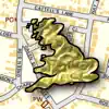
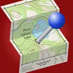
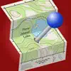
Topo Maps for iPad Screenshots
Product details of Topo Maps for iPad
- App Name:
- Topo Maps for iPad
- App Version:
- 1.19
- Developer:
- Mappendix Limited
- Legitimacy Score:
- 82.7/100
- Safety Score:
- 84.2/100
- Content Rating:
- 17+ May contain content unsuitable for children under the age of 17!
- Category:
- Navigation, Travel
- Language:
- EN
- App Size:
- 112.23 MB
- Price:
- $7.99
- Bundle Id:
- com.topomapsapp.ipad
- Relase Date:
- 24 April 2010, Saturday
- Last Update:
- 18 April 2023, Tuesday - 21:43
- Compatibility:
- IOS 13.0 or later
This is a minor update to fix bugs..