
- 71.1LEGITIMACY SCORE
- 73.6SAFETY SCORE
- 4+CONTENT RATING
- FreePRICE
What is AIS Maps: Marine & Lake charts? Description of AIS Maps: Marine & Lake charts 2720 chars
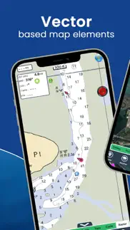
Discover a new perspective on the world with AIS Maps: Marine and Lakes Charts by FlyToMap. Our app is meticulously crafted, offering a seamless blend of aesthetic appeal and functionality. Witness the world in intricate detail, thanks to vector-based map elements that maintain their crispness even when zoomed in, and experience smooth panning, tilting, and rotating for a consistently immersive view.
Unlock the full potential of FlyToMap with our in-app purchase business model, providing access to a comprehensive array of maps, including Marine, Travel, Parks, and Lakes. All these maps are available for offline use at reasonable costs.
Key Features:
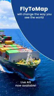
Live AIS Experience real-time map views of your boat and nearby vessels worldwide without the need for an AIS receiver—just your mobile device. Various icons denote different vessel categories, and selecting a target reveals detailed information such as name, MMSI, IMO, call sign, status, speed, heading, coordinates, distance from your GPS location, and more.
Free Features and Functions:
• Latitudes and Longitudes for easy navigation
• Direct search for your favorite points
• Intuitive zoom, rotate, and pan with a touch
• Quick object information with vector technology
• GPS heading for precise navigation
• Distance measurement tool for easy calculations
• Route planning with real-time speed, distance, and bearing updates
• Magnifying lens for detailed information
• Unlimited tracks, markers, geo-tagged photos, and records
• Shareable via email and visible on Google, Flytomap Viewer, and KMZ format
• Depth contours selection
• Background functionality for multitasking
• Optimized battery usage
• Local marine weather forecasts at your fingertips
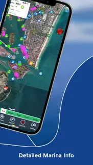
Marine Maps: Explore detailed Electronic Nautical Charts (ENC) with information on coastline, anchoring areas, fishing spots, restricted areas, obstructions, rocks, buoys, beacons, lights, depth contours, spot soundings, and more.
Lake Maps: Access high-quality lake maps featuring depth contours, boat ramps, fishing spots, trails, roads, and railways information.
Park Maps: Discover advanced electronic charts with hiking, biking, and equestrian trails, as well as points of interest like campgrounds, visitor centers, lookout points, eateries, ranger stations, picnic areas, boat/canoe ramps, and parking areas.
Travel Maps: Explore the most captivating tourist areas, combining sea and land information for a comprehensive travel experience.
Stay connected with us:
• Twitter: @flytomap
• Web: flytomap.com
• Facebook: facebook.com/flytomap
Embark on a journey of exploration and navigation like never before with AIS Maps: Marine and Lakes Charts by FlyToMap.
- AIS Maps: Marine & Lake charts App User Reviews
- AIS Maps: Marine & Lake charts Pros
- AIS Maps: Marine & Lake charts Cons
- Is AIS Maps: Marine & Lake charts legit?
- Should I download AIS Maps: Marine & Lake charts?
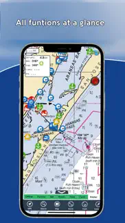
- AIS Maps: Marine & Lake charts Screenshots
- Product details of AIS Maps: Marine & Lake charts
AIS Maps: Marine & Lake charts App User Reviews
What do you think about AIS Maps: Marine & Lake charts app? Ask the appsupports.co community a question about AIS Maps: Marine & Lake charts!
Please wait! Facebook AIS Maps: Marine & Lake charts app comments loading...
AIS Maps: Marine & Lake charts Pros
✓ Very impressedI had a slight issue with a different App by these people and emailed them, i was told it’s an IPhone software update issue that hopefully will get sorted at some point. This company replied straight away and gave me a Free code for this map. Works perfect and extremely good and accurate, definitely a company to purchase from. First class..Version: 6.3.3
✓ Nice chartsFishing around the keys, a good alternative free of cost by the way ..I like the weather and AIS info.Version: 6.3.9
✓ AIS Maps: Marine & Lake charts Positive ReviewsAIS Maps: Marine & Lake charts Cons
✗ Worked well before updateI have used this application for about six months. I originally downloaded the free version. It was quite accurate and easy to use. Because it worked so well, I decided to purchase the full app with a couple of add ons. All I can say is... Save your money!! Barely useable, freezes, crashes and a total waste of money.. I’m using a new IPhone 10max so it should work fine with zero problems... I wish this were the case.. I’m sure there are much better chart, maps, & plotters out there... pass on this one until it works....Version: 5.2.8
✗ Never againBought mistakenly for a yacht cruise from Trinidad to the Grenadines. Disappointing map of Grenada where much of the coast, headlands and offshore islands are cut off, and what on-shore detail there is looks like a scan of a poor tourist flyer. Grenadine islands incomplete and those there are, have scant detail. Even if your position is indicated, the maps may not be adequate to help you find your intended way. Of no use at sea. Regret spending £1.49. Next day bought Navitronics Caribbean and South America, which on first impression provides proper detailed charts..Version: 3.6.1
✗ AIS Maps: Marine & Lake charts Negative ReviewsIs AIS Maps: Marine & Lake charts legit?
✅ Yes. AIS Maps: Marine & Lake charts is legit, but not 100% legit to us. This conclusion was arrived at by running over 89 AIS Maps: Marine & Lake charts user reviews through our NLP machine learning process to determine if users believe the app is legitimate or not. Based on this, AppSupports Legitimacy Score for AIS Maps: Marine & Lake charts is 71.1/100.
Is AIS Maps: Marine & Lake charts safe?
✅ Yes. AIS Maps: Marine & Lake charts is quiet safe to use. This is based on our NLP analysis of over 89 user reviews sourced from the IOS appstore and the appstore cumulative rating of 3.8/5. AppSupports Safety Score for AIS Maps: Marine & Lake charts is 73.6/100.
Should I download AIS Maps: Marine & Lake charts?
✅ There have been no security reports that makes AIS Maps: Marine & Lake charts a dangerous app to use on your smartphone right now.
AIS Maps: Marine & Lake charts Screenshots
Product details of AIS Maps: Marine & Lake charts
- App Name:
- AIS Maps: Marine & Lake charts
- App Version:
- 6.4.0
- Developer:
- Flytomap
- Legitimacy Score:
- 71.1/100
- Safety Score:
- 73.6/100
- Content Rating:
- 4+ Contains no objectionable material!
- Category:
- Navigation, Travel
- Language:
- EN FR DE IT PT ES
- App Size:
- 129.47 MB
- Price:
- Free
- Bundle Id:
- com.flytomap.FTMinAppHD
- Relase Date:
- 01 August 2012, Wednesday
- Last Update:
- 08 February 2024, Thursday - 09:56
- Compatibility:
- IOS 12.0 or later
Charts added: Georgian Bay South Hudsonriver to Raritanbay Lake Ontario West Lake Huron South Lake Erie East Lake Huron North Thousand Islands Lake Ontario East Prince William Sound South Cook Inlet Shelikof Strait East Kodiak Island East Andreanof I....